Bandah Fm
Type Locality and Naming
OUTCROP. Proposed by Narayan (1959) after village Bandah with its type section south of Bandah; redefined by Mishra et al., (1993). [Original Publication: Narayanan, K. 1959. Progress report on the geological work in Jaisalmer, ONGC report (unpublished)]. Reference well: In two locations, Batrewala Tibba and Shumarwali Talai, and well Kharatar-1, (interval 302-511m).
Lithology and Thickness
Clayey limestone. In the type area it consists of predominantly of limestone. Yellow calcareous siltstone, greenish marl, bentonitic greenish clays thin beds of calcite at the base. The middle and upper parts comprise of shale and limestone occasionally laterites. About 30 m thickness.
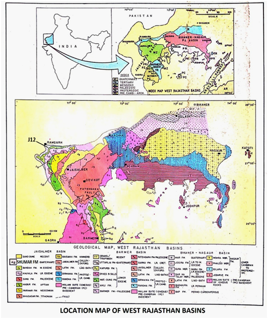
[Figure 1: Location map of West Rajasthan Basins (after Pandey and Dave, 1998)]
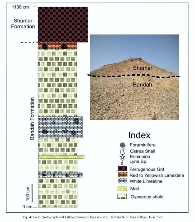
[Figure 2: Facies Analysis, Reservoir Characterization and Depositional Environment study of Hydrocarbon bearing Tertiary Sequences in Jaisalmer Basin, Rajasthan (after R. Pandey et.al., 2019), ONGC Bulletin, Vol. 54, No.1)]
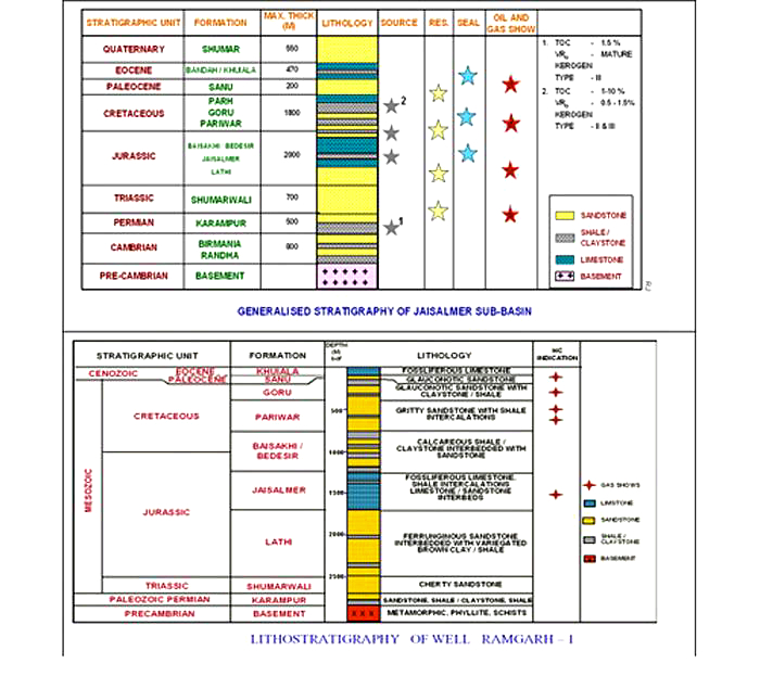
[Figure 3: Generalized and Subsurface Stratigraphy of Jaisalmer Basin (from dghindia.gov.in)]
Relationships and Distribution
Lower contact
In outcrops, the lower boundary has a disconformable contact with underlying Khuiala Fm. In subsurface, the lower boundary is placed between the limestone of Bandah Fm and calcareous/sandy shales of Khuiala Fm.
Upper contact
The upper boundary is marked by a pronounced unconformity throughout the basin. It is overlapped by the Shumar Fm (Plio-Pleist.)
GeoJSON
Fossils
Foraminiferal assemblage recorded by Sigal et al., (1971) and Singh (1976,1984) includes: Nummulites acutus, N. maculates, N. beaumonti, N. pengaronensis, N. cuivelleri, Discocyclina javana var. indica, D. dispansa, D. sowerby, Fasciolites ellipitica, Assilina spira, A. papillata, A. subpapillata, Dictyoconoides cooki. Others include Globigerinatheka kugleri, Truncoroloides topilensis and Turborotalia cerroazulensis. Singh (1984) has recorded a different assemblage from the top most part of this formation in the Kharatar area. They include N. pengaronensis, Pelllatispira sp., Baculogypsinoides sp. and Chiloguembelina sp. from this horizon. Ostracodes: Characteristic ostracodes recorded are: Alocopocythere transversa morp.A, Anommatocythere confirmata, Echinocythereis (S.) sahnii, Gyrocythere exaggerate, Cytherelloidea khartarensis, Alocopocythere transversa morph-A, Stigmatocythere lumaria morph.B and Echinocythereis (S.) sparsa.
Age
Depositional setting
Foraminifera from the limestone greenish grey clay and glauconitic marl in association with planktics suggest inner to middle shelf conditions. The upper part of Bandah Formation deposited in shallow inner neritic.
Additional Information


